Agricultural Applications of GPS
Among the many applications of the Global Positioning System is the rapid survey of agricultural fields.
 |
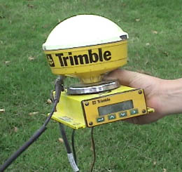 |
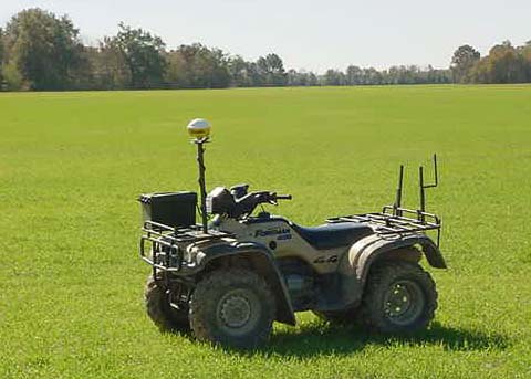
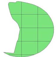
With a rugged, field-model GPS unit with a high-gain antenna, a field survey may be done rapidly with a 4-wheel, all-terrain vehicle. The accompanying software calculates the field size, plots an outline of the field and breaks it up with a grid to facilitate the collection of sample data on the field.
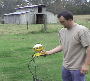
The use of the GPS unit makes practical a systematic sampling of an agricultural field of any size or shape. With portable software, the unit can indicate which grid the user is in, so that soil samples may be taken. With systematic soil samples, the appropriate amount of fertilizer can be applied to different areas of the field. The use of the GPS can easily pay for itself in the cost savings on fertilizer and other chemicals. Once the crop is planted, the same GPS-guided procedures can be used to survey plant disease or insect infestation and tailor the treatments of the crop to the needs in each sector. Data on field size and needs can be collected quickly and available computer software used to calculate the materials list for the treatment of the field. 使用GPS单元使对任何大小或形状的农田进行系统采样成为现实。借助便携软件,该单元可以指示用户所在网格,从而可以采集土壤样本。通过系统化的土壤样本,可以将适当的肥料施用于田地的不同区域。使用GPS所带来的成本节约在肥料和其他化学品的节省上可以很快收回成本。一旦作物种植完毕,相同的GPS引导程序可以用来调查植物病害或虫害,并根据每个区域的需求定制作物的处理方式。田地的大小和需求数据可以迅速收集,并利用可用的计算机软件计算出田地处理所需的材料清单。
|
 |
In rice-growing country, the GPS is increasingly used to map out the field terrain for the laying out of dikes for flooding the rice. The GPS technology can map the elevations and map the needed dikes.
| GPS Satellites
GPS 卫星 |
Orbit concepts
Reference
| HyperPhysics***** Mechanics
力学 | R Nave |